Mapping Switzerland under ground
Deep under the ground we can harvest energy, store carbon dioxide and transport merchandise. New 3D models are going to help us get the information we need to do all this.
What lies underground in Switzerland has now been mapped thanks to old data that have been collated to provide an overall picture. | Image: Swisstopo.
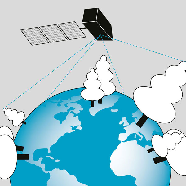
If you want to know what things look like on Mars, many millions of miles away, you can easily find a whole host of photos and maps on the Internet. By contrast, the world right under our feet remains largely unknown. But interest in the Swiss subsoil and bedrock is growing all the time. In future, geothermal energy will be used to produce electricity. Geologists are looking underground to find spaces to store radioactive waste and the greenhouse gas CO2; and the company Cargo sous terrain wants to shift much of Switzerland’s goods transport system underground.
The Midlands in 3D for civil engineers
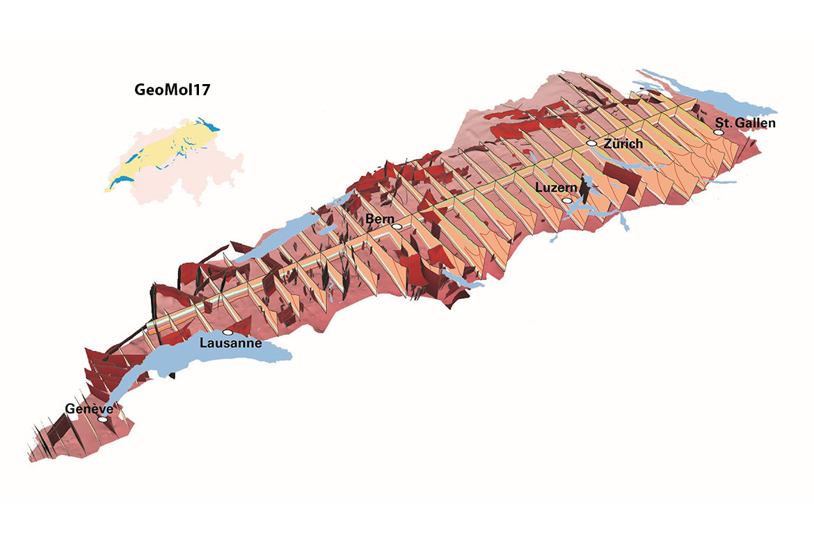
Most of these projects are planned for the Swiss Midlands – one of the country’s most densely populated areas. In order to advance the planning for these projects, the Swiss Federal Office of Topography (Swisstopo) has developed a complex 3D model depicting the geological composition of the subsoil and bedrock, from Geneva through the Midlands to eastern Switzerland. This so-called molasses basin ranges from a few hundred metres in depth in the north to some six kilometres in the south, and comprises sedimentary layers such as limestone, sandstone and clay. These sediments date from around 30 million years ago, when Switzerland was still covered by the oceans.
“Thanks to three-dimensional visualisations, decision-makers who aren’t experts in the field can now get a better understanding of the subsoil and bedrock”, says project head Robin Allenbach from Swisstopo. With the aid of the Geomol 17 model, for example, civil engineers can predict more reliably the types of stone they will encounter when constructing a tunnel. This means they can in future avoid building tunnels through unfavourable formations – such as through unhardened rock.
This is why Geomol 17 has already played an important role in planning the route network for “Cargo sous terrain”. This project aims to connect the large cities of the Midlands with a tunnel six metres wide, in which goods can be transported from place to place by unmanned, fully automated vehicles. According to the company, in future up to 40 percent of all goods transport could proceed like this, under the ground. The first portion of the network should be ready for business by 2030. It will be some 70 kilometres long and will link Zurich with Niederbipp in the canton of Solothurn.
Besides the thickness and the course of the sedimentary layers, GeoMol 17 also visualises places where fractures occur. Knowing the position of these fault planes is an important criterion when choosing sites for underground construction projects, such as deep drilling. “Using the 3D model, for example, you can deliberate on how water flows through these faults, which is very important for geothermal plans”, says Gunter Siddiqi, an expert on the matter at the Swiss Federal Office of Energy.
Whereas earlier depictions only showed a handful of such fault zones, GeoMol 17 is now mapping the position of some 600 of them. “In this regard, the project is incredibly important for Switzerland”, says Siddiqi.
Scanning old data
For GeoMol 17’s modelling, the geologists didn’t use any new data, but consolidated many thousands of existing datasets from different sources, in particular from Seag, a company that has been carrying out exploration for oil and natural gas in Switzerland since the 1950s, and from Nagra, which has been conducting geological surveys for many years in order to find underground storage space for radioactive waste.
Measurements from other private companies, research projects and topographical maps were also utilised. “The most complex problem was to turn this into a uniform set of data, because some of it was very old”, says Allenbach. “We scanned and processed masses of papers”. In order to cope with this abundance of material, Swisstopo was joined by the Geological Museum of the canton of Vaud and the universities of Geneva, Fribourg, Bern and Basel, each of which took on a segment of it.
They also acquired fundamental information on the structure of the bedrock from new analyses of data from earlier drilling. This involved using drill cores and crushed materials that had been analysed on the surface to help them understand the composition of the rock layers in the Earth.
“This means we have acquired a very good understanding of the bedrock in Switzerland, though regrettably only in a few places”, says Siddiqi. Exploring the subsurface is expensive and complex – and is accordingly undertaken rarely. Up to now, only 165 drilling operations have been conducted in Switzerland to a depth of more than 500 metres, which corresponds to roughly four drilling operations for every 1,000 square kilometres.
Seismic measurements are not so rare, though they only offer indirect evidence. To this end, geophysicists create artificial tremors in the ground using vibrators or explosions. By measuring the speed with which the waves of these tremors spread underground, geologists can determine the structure of the rock layers. “Using 3D seismology, we can today depict fault planes in high resolution, tens if not hundreds of metres”, says Marco Herwegh, a professor of structural geology at the University of Bern.
Seismic waves triggered by natural earthquakes can also be used to map the bedrock. The Alparray project, which is coordinated by ETH Zurich and the University of Lausanne, has in recent years created a network of 600 seismographs in the Alpine region and the Mediterranean that can register even the slightest of tremors during weak earthquakes.
Seeking hot springs
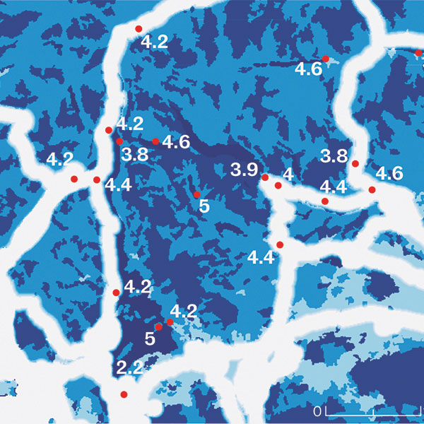
Despite projects such as Alparray, there is still no comprehensive 3D model of the bedrock under the Alps – even though this would be desirable. Experts surmise, for example, that there are numerous underground hot springs in the Alpine region – proof of which is provided by the many thermal springs in the canton of Valais. Hot spring water means conditions are promising for generating geothermal electricity (see also the box “Electricity from the depths using CO2”). This is why geologists are trying to reconstruct the paths of thermal water underneath the Alps. They are using chemical analyses to find out how old the water is, and through which rock types it has flowed. “But where this water actually originates in the Alps remains one of Switzerland’s biggest geological puzzles”, says Siddiqi.
All the same, the first steps have already been made on the way to a 3D model of the Alpine bedrock. Herwegh, for example, is currently working with his research group on a model of the Aar Massif. In addition to the available seismic data, he is also analysing the layers and faults in the visible rock formations. These cut through the surface of the Earth along specific intersecting lines. The researchers can then extrapolate these from the surface down into the depths. This means they can predict how the rock continues under the Earth. Herwegh is convinced that the work his geologists are investing in these 3D models will pay off in future. “These models generate information about where you can have a good chance of success with geothermal drilling – though there isn’t any 100 percent guarantee, and this is what makes it all so exciting”.
In Iceland, hot water flows close to the surface on account of the volcanic subsoil there, and it’s used successfully to generate electricity. “Here in Switzerland, however, you’d have to go to a depth of four kilometres to find water at temperatures of 100 to 120 degrees Celsius, which is what conventional technologies need”, says Gunter Siddiqi of the Swiss Federal Office of Energy. And pilot projects in Basel and St. Gallen have shown that such deep drilling could even trigger earthquakes. What’s more, it’s very complex and expensive.
This is why they’re looking for technologies to produce electricity efficiently at lower depths. One idea comes from Martin O. Saar of ETH Zurich. He wants to use underground carbon storage sites. These already exist in the USA, where they reduce the CO2 emissions of large power plants and factories by more than 90 percent. Saar believes that such storage sites will be created in Switzerland in the near future. Here, at a depth of roughly 2.5 kilometres, the gas will increase in temperature to some 80 degrees Celsius.
“We could bring this geothermally heated CO2 briefly to the surface in order to create electricity with it, and then pump it down into the Earth again, where it will ultimately be stored permanently”, says Saar. “Given the physical properties of CO2, you could produce electricity with it twice as efficiently as it’s been possible with water up to now, at a lower depth, and more economically”. Saar hopes he will soon find the money for a pilot plant.
Yvonne Vahlensieck is a freelance science journalist who lives near Basel.