The multi-coloured forest
The human eye is only sensitive to a limited part of the spectrum. Infrared drone photographs of forests can therefore be surprising.
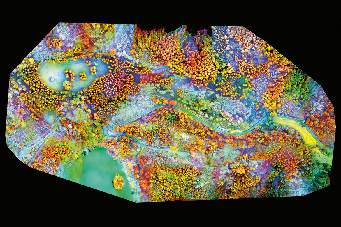
Image: Adrian Meyer
“I was surprised by this explosion of colours”, says Adrian Meyer, a geomatics specialist at the University of Applied Sciences and Arts Northwestern Switzerland FHNW in Muttenz. “Normally, these kinds of images are duller – the water comes out black, the buildings green and the forest red”. Yet here, we find yellow and blue trees and a turquoise pond and roads.
This image is the result of a meticulous process. A drone mapped a 400 x 900 metre area of the Black Forest near Basel for three quarters of an hour. Its multispectral camera is sensitive to several different wavelengths and took 431 pictures with a resolution of 10 cm. They were then juxtaposed using one piece of software, after which another was used to set the colours for each set of wavelengths. In this case, red, blue and green were chosen respectively to reproduce greens, near infrared and reds at the edge of the visible spectrum. These last two bands are interesting because they reflect the rate of photosynthesis in plants, and thereby also their health. The outer edge is oval because the lower number of peripheral images generates distortions in the corners when juxtaposing the images.
The resulting representation shows a healthy grass field (yellow, below the road on the right), hay in a deer park (small yellow square at the top left), and leafless trees (light blue at the top). Meyer then processes this type of image using artificial intelligence: machine-learning algorithms attempt to predict the presence of mammals, attracted by healthy grass and dense vegetation cover.
According to Meyer, this photo – which won a prize at the 2019 SNSF Scientific Image Competition – is partly the result of chance: “I was trying different colour combinations when I came across this composition. It illustrates the enormous potential of these techniques to give us new perspectives on things we think we know very well” - such as a forest.