Gently down the stream
From Grimsel through Lake Thun to Bannwil – the River Aare meanders almost playfully through the canton of Bern. But it’s also a vital research resource. We look at six projects that make their own contribution to the flow of knowledge.
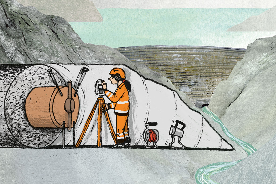
Four heatable containers have been wired up and sealed in the Aare Massif. They’re there to test whether radioactive waste can be stored safely. | Illustration: Andrea Peter
The ultimate storage facility
If you ever happen to paddle down the River Aare in a canoe, you will pass three nuclear power plants. They all present a well-known problem: how can radioactive waste be stored safely and permanently? At the Nagra Rock Laboratory on the Grimsel Pass in the Aare Massif where the river has its source, a solution has perhaps been found. It is the result of forty years of ongoing research. Nuclear waste is currently stored in the Würenlingen interim facility, many kilometres downstream from the Aare, but it will at some point in future be enclosed instead in a deep geological repository where it can remain for tens or even hundreds of thousands of years. The long-term experiment HotBENT, led by Florian Kober, has been exploring one of the challenges of setting up such a permanent facility, namely: What happens when the absorbent clay mixture bentonite is exposed to high temperatures over a long period of time? “This is the material”, says Kober, “that will be used to fill and seal the tunnels that will be the ultimate resting place for the nuclear waste containers. Bentonite absorbs water from the environment and can safely isolate the waste”.
Kober and his research team already know that this works up to 150 degrees Celsius. In order to be able to observe the impact of temperatures between 175 degrees and 200 degrees Celsius, they have in recent months installed four heatable containers deep in the rock that are wired up with 1,500 sensors to take constant measurements of the temperature, humidity and pressure. They have been heating these containers since September 2021, and they will remain enclosed there for up to twenty years. The team at Nagra thereby hopes to achieve a better understanding of the processes involved, and optimise the final repository for the nuclear waste.
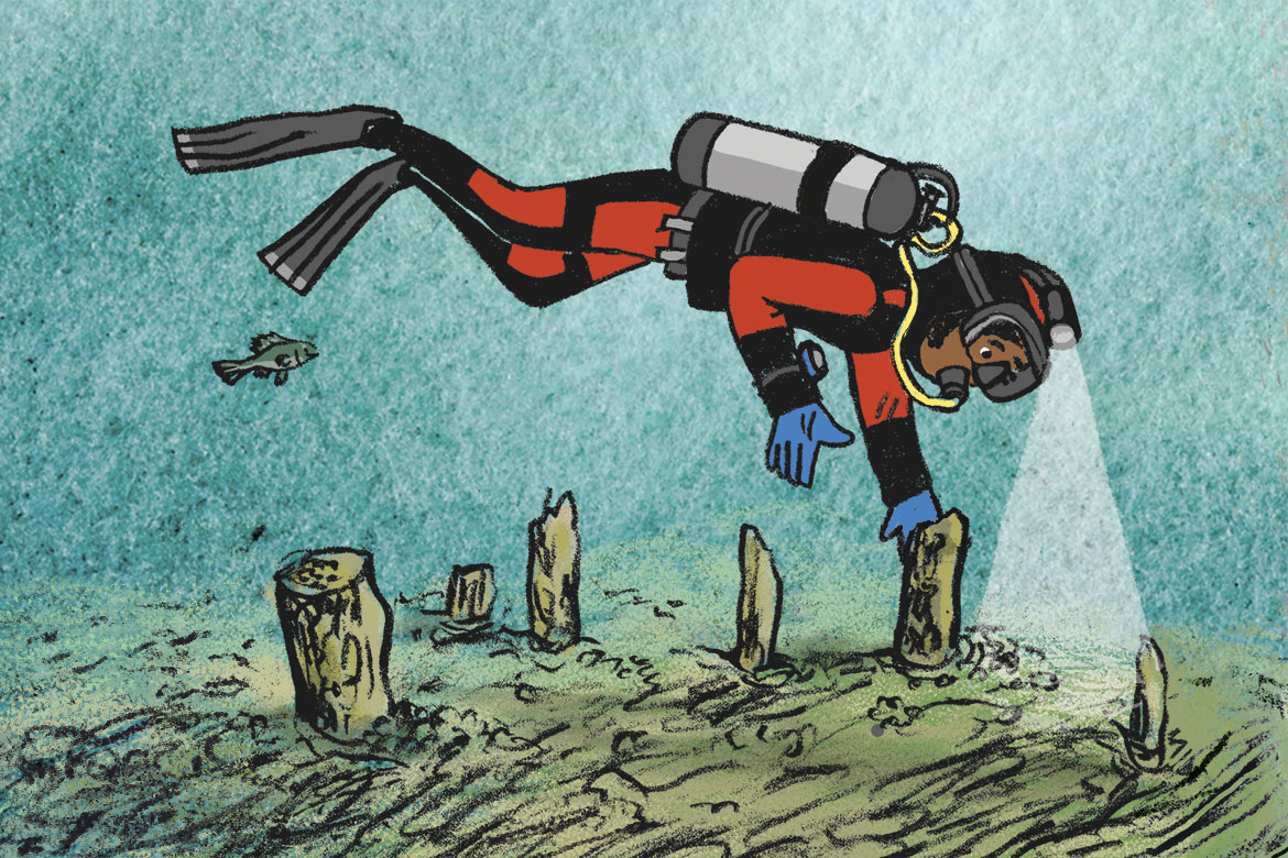
Hundreds of objects from the Bronze Age have been discovered at the bottom of Lake Thun. | Illustration: Andrea Peter
Diving back in time to the pile dwellers
Not long after it enters the wild Aare Gorge, Switzerland’s longest river flows into Lake Thun on the border between the Alps and the Central Plateau. Archaeologists began to take an interest in the lake in 2014 when a sports diver revealed spectacular bronze finds that he had made by chance on the lake floor. The Archaeological Service of the canton of Bern promptly investigated the site in question, which is situated in the shallow waters just offshore from the town of Thun. “In the process, we discovered more than 200 piles over an area of more than 15,000 square metres”, says the archaeologist Lukas Schärer. “We also found fragments of pottery, arrowheads, daggers, fishhooks and needles”.
These objects have been dated back to different settlement periods: first between 1590 and 1550 BC, then from around 1050 and 950 BC. This means that the wooden posts can also provide new insights into the settlement history of Switzerland. Until now, the lakes of the Central Plateau were considered to have been the most popular settlement sites in the Bronze Age. But it is now clear that large settlements also repeatedly emerged around Lake Thun. “It is possible that this site was already strategically important 3,000 years ago, as it was on the route between the Aare Valley and the Valais”, says Schärer. Prehistoric relics have also been found in the ice fields of the Lötschen Pass. It still remains unclear, however, whether or not other remains of pile-dwellers are still hidden in Lake Thun or in neighbouring Lake Brienz. In the coming years, regular diving expeditions are planned in order to uncover any further remains that might be hidden in the sediment on the lake floor.
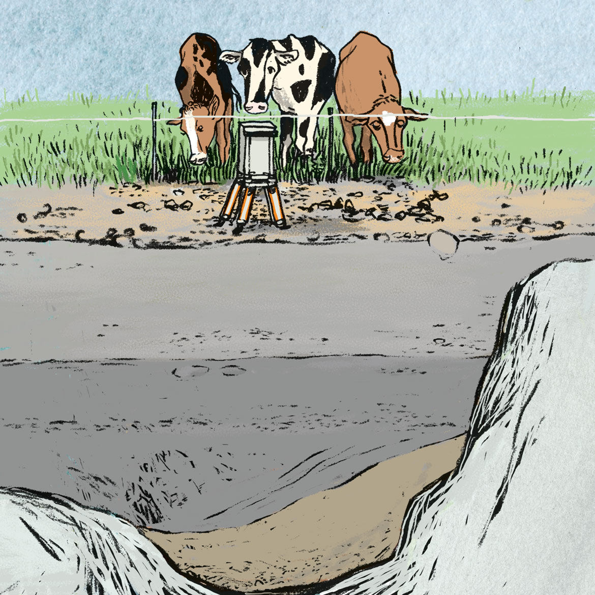
There used to be massive glaciers in the Aare Valley. They left their mark in canyons that still lie hidden, 200 metres below the valley floor, and are today full of debris and earth. | Illustration: Andrea Peter
Measuring hidden canyons
From Thun, the Aare flows in leisurely fashion through the idyllic Aare Valley towards Bern. Its banks are lined with gentle hills, and in summer, thousands of people delight in riding along the river in dinghies. Fish cavort in the water, dragonflies flutter around. But one thing remains invisible: more than 200 metres below the valley floor today, deep rock canyons lie hidden that were formed as the glaciers advanced and retreated, and that have long since been filled with debris, rubble and earth.
The Institute of Geology at the University of Bern is currently measuring the geometry of the hidden bedrock. One of their core instruments is a sensitive gravimeter that measures gravity at different points. Because it is influenced by the density of the soil, this means that the researchers can create a profile of the rock without having to drill into it.
“We have been able to show that steep canyons are hidden in the ground below the Aare Valley”, explains the joint study leader Fritz Schlunegger, a geologist at the University of Bern. “These so-called ‘overdeepenings’ were cut into the rock by glaciers”. Their measurements have helped them to reconstruct the chronological sequence of erosion by glaciers during ice ages and interglacial periods.
During the glaciations that took place between 200,000 and 150,000 years ago, the massive glaciers in the Aare Valley primarily dug deep into the interior. During the last major period of glaciation, however, which came to an end 20,000 years ago, glacial abrasion affected the slopes along the sides of the valley. Schlunegger and his team now have a better understanding of how glaciers shape our landscapes over thousands of years.
The consequences of extreme weather situations are simulated in order to provide the best possible protection for the population whenever the Aare overflows its banks. | Illustration: Andrea Peter
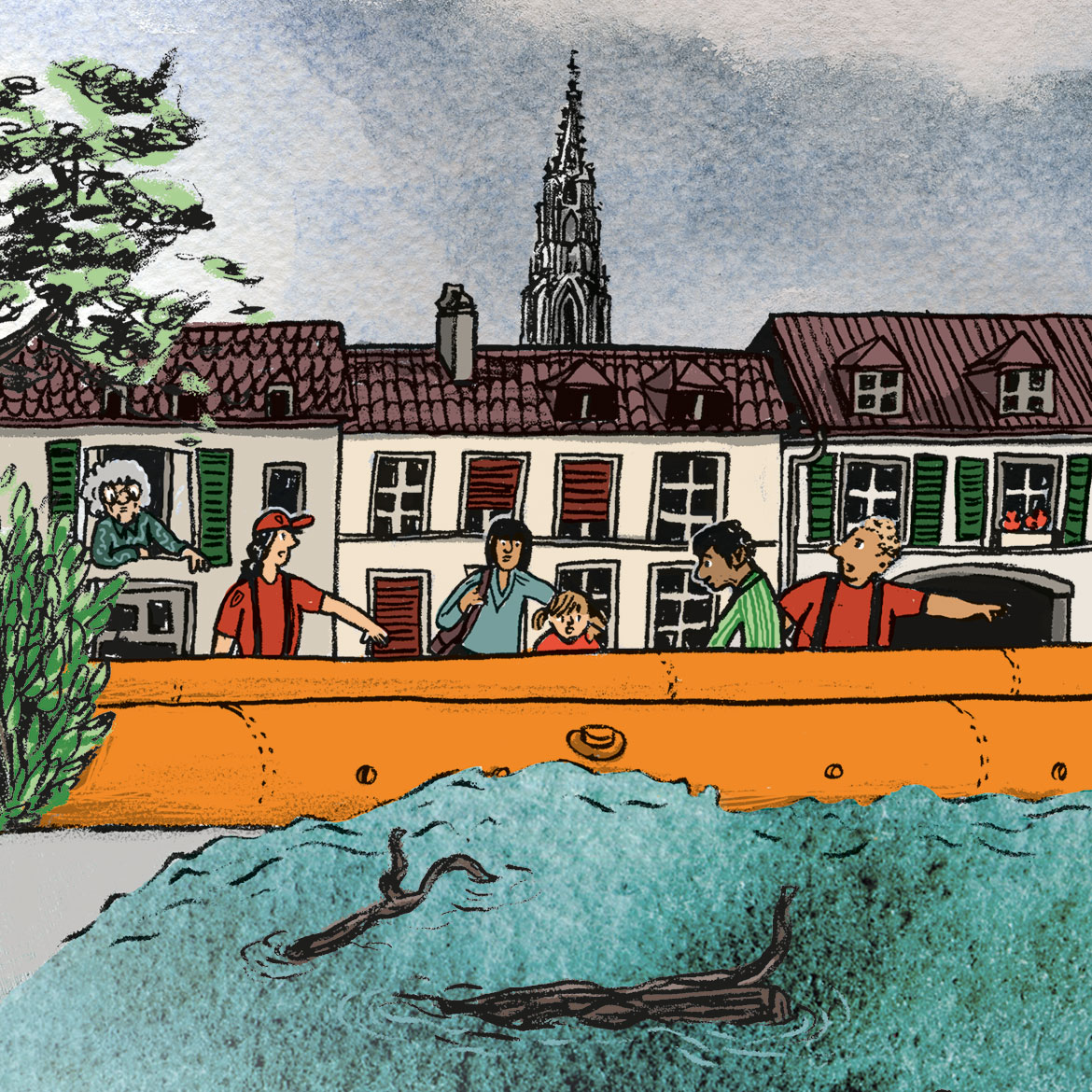
When the water comes
Every few years, the Aare swells up menacingly. The current increase in extreme weather events also means an increase in the potential danger to buildings and people from flooding along the river’s 288 kilometres. If adequate protective measures are to be instituted, it is important to know the places where the river is most likely to overflow its banks with the greatest force. But researchers and the civil protection authorities are also interested in the temporal course of floodwaters. The Mobiliar Lab for Natural Risks at the University of Bern is trying to improve our understanding of these dynamics. To this end it, has developed a simulation tool that shows various extreme yet realistic flood scenarios along the banks of major Swiss rivers.
The tool’s nine different simulations point the way to possible answers to core questions. According to the project’s co-director Andreas Zischg, these include: “How many kilometres of road will be flooded in which area and when? How many houses will be affected, where, and when? And will schools, hospitals or nursing homes be affected?”. The different scenarios visualise the spatial and temporal effects of flooding and are based on weather forecast data from the archives. This hydrological data is then combined with information on the location and number of hospitals and schools, the market value of houses, the roads in the vicinity, and any people who might be affected. In this way, a seemingly unsolvable jigsaw puzzle is transformed into a comprehensible image of a natural hazard as a tangible, dynamic situation. This can help us to better understand what measures might be necessary, and when.
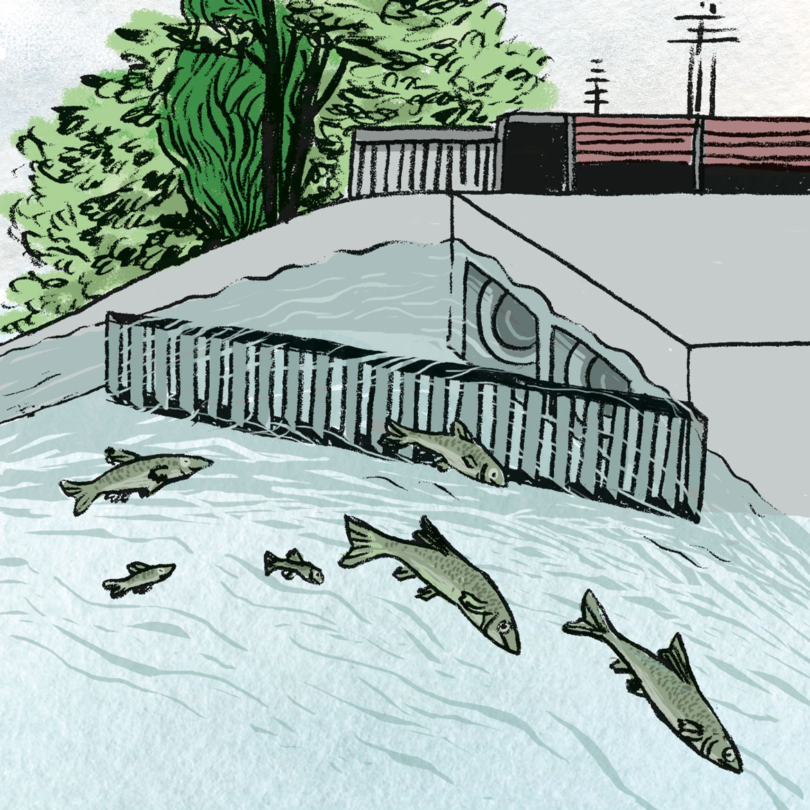
‘Fish passes’ help barbels, eels and trout to avoid power stations when swimming upstream. But when swimming downstream, they often get caught in turbines. Researchers are looking for solutions. | Illustration: Andrea Peter
Go, fish
Hydraulic power plants on rivers are often insurmountable obstacles to fish. Along the course of the Aare, they have to contend with some twenty of them. Although ‘fish passes’ have been installed in many places to provide fish with an alternative way to swim upstream, there is no solution for them to swim downstream that would also work in the case of larger power plants. The problem is that barbels, eels and trout follow the current and so get caught in the turbines, where roughly a third of them perish. There are plans to try and change this – but how do you build a cost-effective, long-lasting facility for fish to go downstream that they will really use?
Several pilot projects along the Aare are exploring these new possibilities. At the Bannwil and Wildegg-Brugg hydropower plants, researchers are investigating how fish might be guided reliably away from the turbines towards a bypass. Engineers from ETH Zurich in collaboration with fish biologists from the Swiss Federal Institute of Aquatic Science and Technology (Eawag) have been developing grilles in their laboratory that can change the flow of the water and thereby guide the fish in the desired direction. The fish biologist Armin Peter has also analysed migration behaviour among fish in the Aare itself: When do which fish like to migrate? How far do they swim? And where do they want to go? Conditions in the river itself are more complex than in the lab. “Our system has to function in all situations, whether at low water or high water”, says Andreas Stettler, who is involved in the pilot projects. “What’s more, driftwood could have an impact on the delicate guiding grilles”. Their next steps in Bannwil will therefore be to analyse the real-world impact in order to develop a solution that will work in practice.
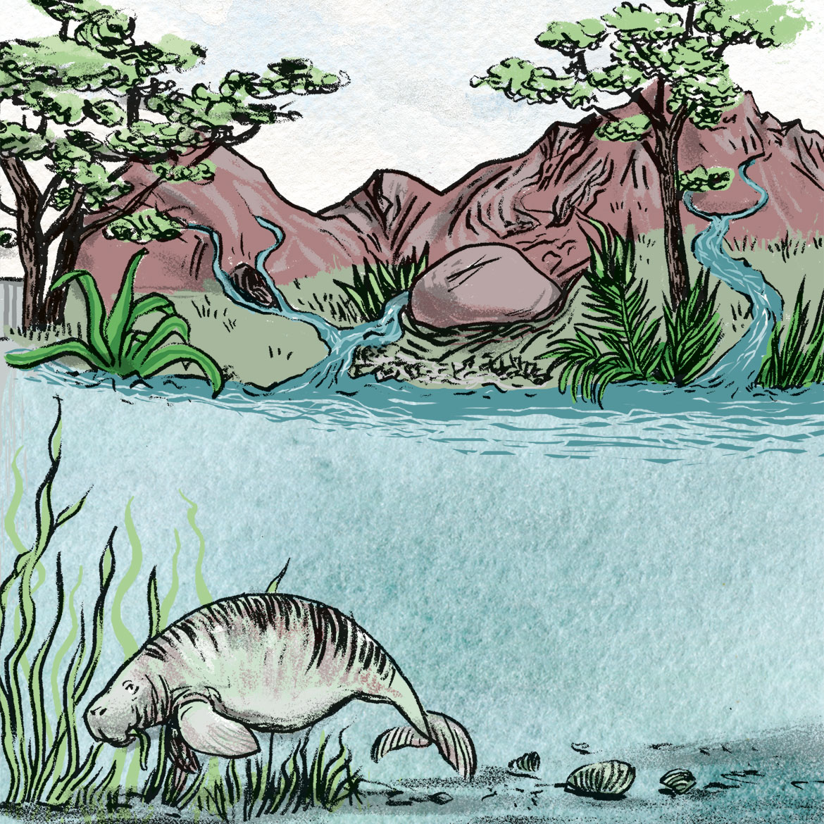
Sixteen million years ago, the Aare flowed into a gigantic Molasse lake. Back then, primeval creatures swam where the Swiss Central Plateau is situated today. | Illustration: Andrea Peter
Nothing is as it was
Citizens of Bern have never been in any doubt: the Aare is Switzerland’s most important river (after all, it flows through their capital city). Its drainage basin covers some 43 percent of the whole country, including the northern slopes of the Alps and almost the entire Central Plateau from the Lac du Joux to Lake Walen, until it flows into the Rhine at Koblenz. However, the course of the river was once rather different. Probably the best-known intervention in its course was the creation of a canal to channel the river into Lake Biel, during the first phase of the Jura water correction that was carried out from 1868 to 1891. The old Aare still exists between Aarberg and Nidau and bears witness to how things used to be.
Fritz Schlunegger from the University of Bern has traced the history of the Aare much further back, and found that the primeval river has changed direction repeatedly since it first emerged some 30 million years ago. Sometimes it flowed to the east, sometimes to the west, and at one point even to the north. Sixteen million years ago, it even flowed into a gigantic Molasse lake where the Swiss Central Plateau is today. However, all these versions of the Aare always had their origins in what is now the Bernese Oberland. The fact that the Alps unfolded here was also the reason why the Aare never flowed south. It was only around 2.6 million years ago that the river more or less assumed its present form. However, it still continued to avoid the site of today’s city of Bern for a million years, flowing instead directly north by way of Lucerne. The ice ages and warmer periods of the last 500,000 years changed that. But one question remains unsolved for Schlunegger: Where will the Aare flow in the future? It is perfectly possible that it will once again choose a path to the west.