REPORT
Ascent to the permafrost
Rock glaciers harbour large bodies of ice inside them – so-called ice lenses. The PERMOS monitoring network is observing them in order to gain a better understanding of the state of the frozen subsurface of the Alps. We joined two researchers on a hike along an inhospitable stretch of scree in Val Muragl.

The Muragl rock glacier contains metre-thick ice. There are several boreholes on its tongue that are used to analyse the state of the permafrost. | Photo: Mara Truog
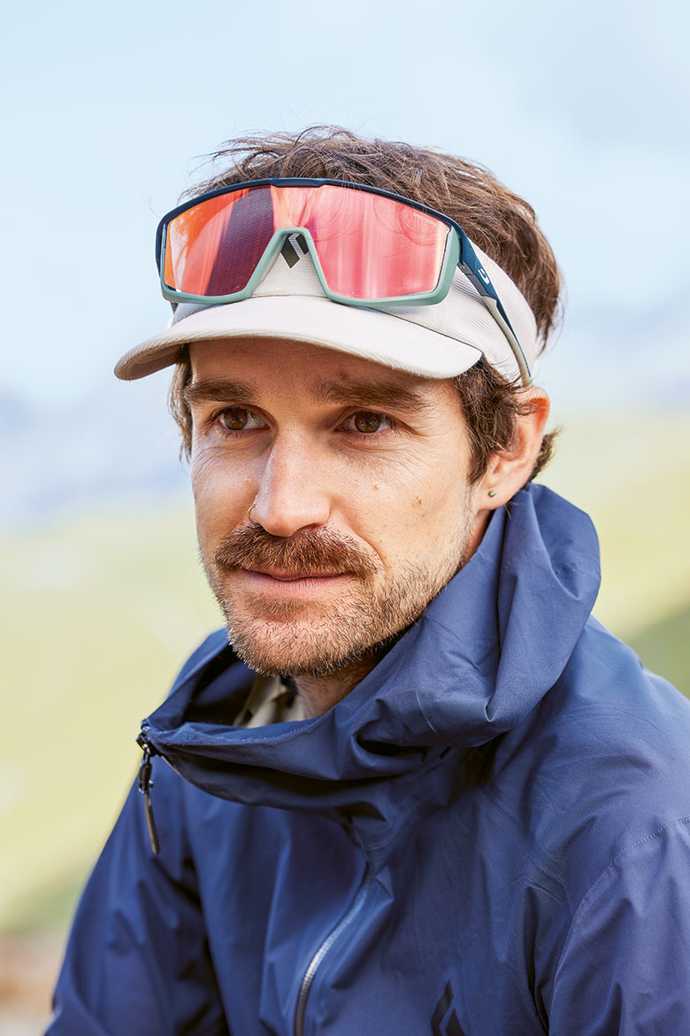
The Muragl rock glacier – a rough, brown-grey mass of stone and rock – gently bends to the left down towards the valley, below the steep scree slope of the Piz Muragl. But according to Jeannette Nötzli, describing this kind of terrain as a ‘glacier’ can be a bit confusing. She’s the head of the Swiss Permafrost Monitoring Network, ‘PERMOS’ for short, which has been monitoring the condition of the permanent ground frost of the Swiss Alps for the past 25 years. It’s attached to the Institute for Snow and Avalanche Research (SLF) in Davos (which itself is a division of the Swiss Federal Institute for Forest, Snow and Landscape Research WSL). We’re high above Samedan in the canton of Graubünden, looking out at the dramatic landscapes with the station of the funicular railway behind us. “A rock glacier is not really a glacier”, she says. This protruding, “icy, creeping scree slope”, as she prefers to call it, is one of around 30 PERMOS sites in the Alps.
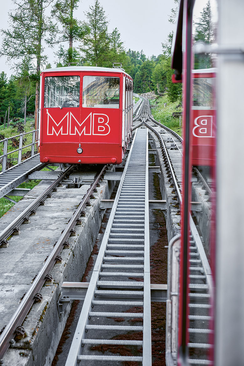
The funicular railway takes you up to Muottas Muragl. | Photos: Mara Truog
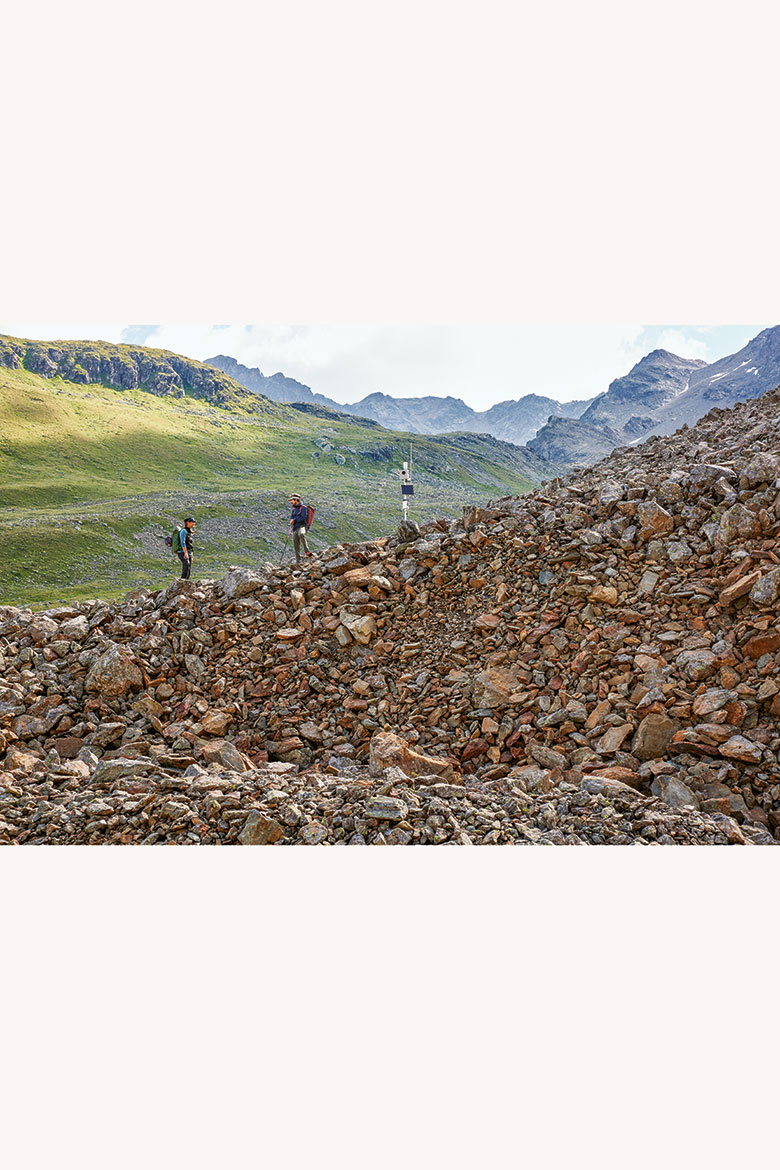
You can observe the state of the permafrost well from the ridge of the Muragl rock glacier – or the “icy, creeping scree slope”, as the researcher Jeannette Nötzli calls it.
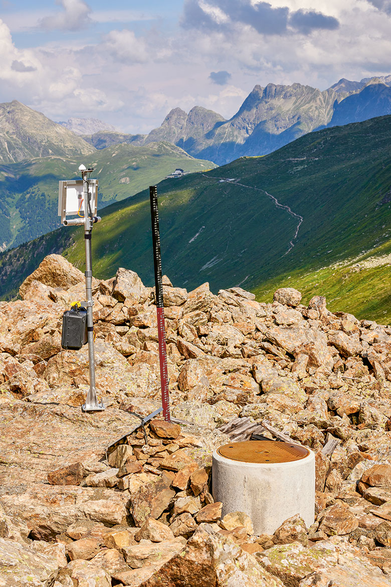
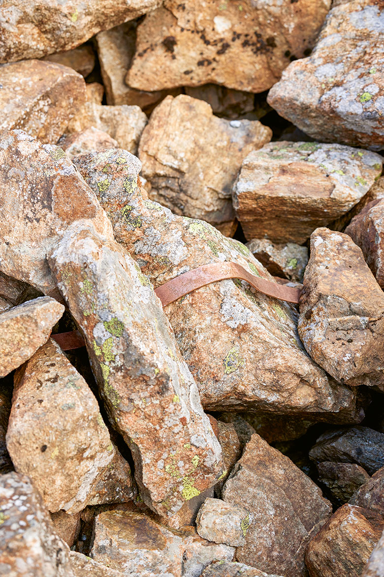
Thanks to their concrete casings and manhole covers, the boreholes are perfectly camouflaged in the scree. Weather data is also measured here with more obviously visible instruments.
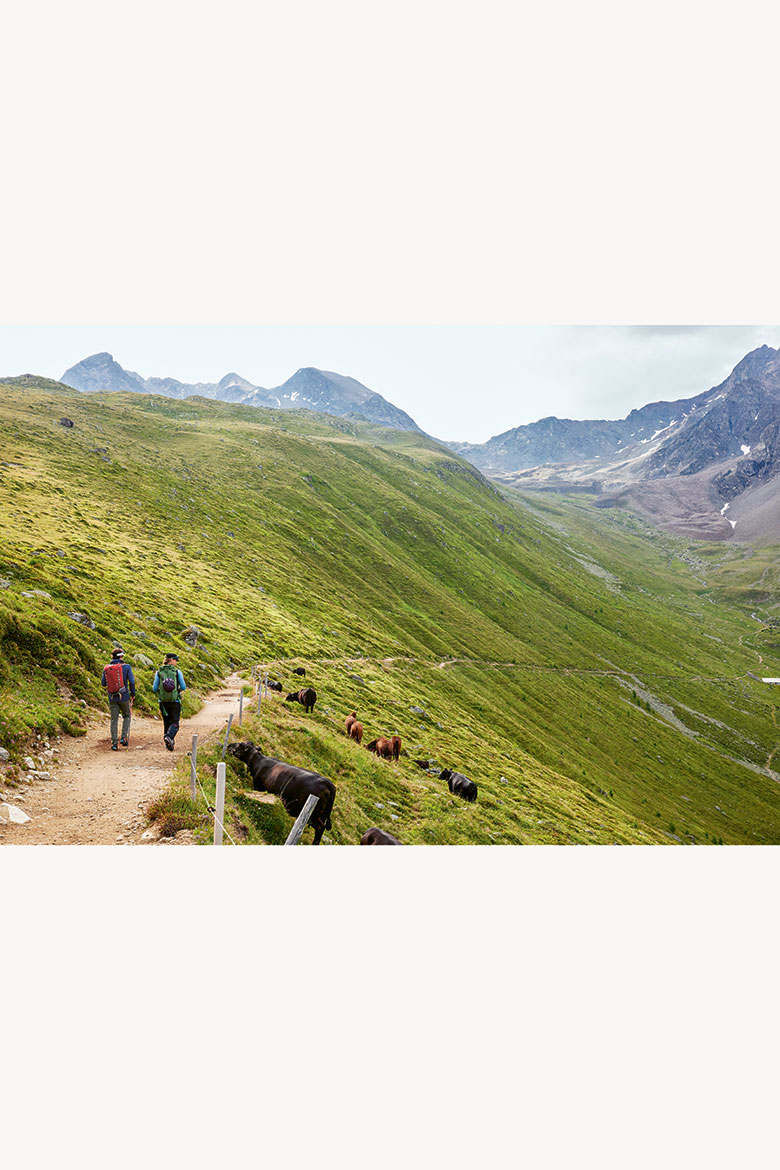
Hiking from the topmost funicular station to the rock glacier takes just under an hour.
Lightning conductors protect the measuring stations and channel the electrical energy into the rock.
As a rule, says Nötzli, we find permafrost in locations where there are no more self-contained grassy areas. It is often at roughly 2,200 metres above sea level, hidden in rock faces and scree areas. The ground temperature in the invisible subsoil has to be zero degrees Celsius or less, all year round. In Switzerland, permafrost is found in less than three to five percent of the ground, depending on the terrain.
A rock glacier is a clear indicator of the presence of permafrost, and often contains massive ice lenses several metres thick that result in a bulging ridge high on the surface. Matthias Lichtenegger is a PhD student from Graz in Austria who’s investigating the movements within these massive scree slopes, and he believes that there are several thousand of them in Switzerland.
Descending one metre per year
The rock glacier in Val Muragl is currently moving down towards the valley at a speed of just over one metre per year. Nötzli says that the speed of these long tongues of icy, rocky debris has generally increased in recent years. In 2024, for example, their speed across Switzerland as a whole was some 40 percent higher than in the previous year. That was also the second-warmest hydrological year since systematic meteorological measurements first began in Switzerland, back in 1864.
PERMOS has been collecting data at most of its sites for more than two decades, including at the Muragl rock glacier, where the first borehole was drilled in 1999. The five most recent boreholes, which are between 15 and 25 metres deep, were drilled into the mass of rock and ice over a period of three weeks in August 2024. They were made specifically for a research project analysing the dynamics of rock glaciers across the Swiss Alps – a project in which Lichtenegger is involved.
This rock glacier is mightily impressive as it oozes down the slopes from around 2,500 metres above sea level, but the measuring stations on its rugged back are decidedly unimpressive in comparison. After you’ve climbed the roughly 20 metres up its ridge of reddish stones, you feel lost in the inhospitable expanse before you, and the station’s concrete pipes and metal borehole covers disappear into the rough sea of rocky debris that lies all about.
“You can’t see the rock glacier for all the stones”, says Nötzli, laughing. After walking further up carefully – it hurts if you slip and fall on the hard rocks – you’re finally able to see the boreholes that are the proof of the scientific work being carried out on site.
Fountains of water
PERMOS uses three different parameters to monitor the condition of the permafrost. First, there’s the temperature in the ground. The sensors in the boreholes accordingly register the temperature at different depths, from the bottom upwards. At a certain depth, the temperature rises to zero degrees and the subsoil slowly begins to thaw; at this depth, the temperature remains almost constant for a long time.
In order to understand the shifting proportions of ice and water in this mixture of rubble, gravel and sediment, the researchers measure electrical resistance. This is their second parameter. “We send electricity into the ground; water conducts it much better than ice”, says Nötzli.
The Muragl rock glacier has more water in the scree than she and her team had previously assumed. This became apparent when they were drilling in August 2024: “Metre-high fountains sprayed out of the holes when we were flushing them”. The increasing presence of water in the frozen ground has an impact on its stability, because it causes additional heat and pressure. “Permafrost seals the ground and is impermeable to water”, says Nötzli.
The third parameter that they measure is the velocity of the rock glacier. “Altogether, these measurements give us a comprehensive picture of changes to the permafrost and provide the data we need in research and practice to enable us to develop models”.
Permafrost is always just one factor
Model calculations help Nötzli et al. to make more accurate estimates of future conditions, also in rockfall initiation zones. But she warns that “the thawing of permafrost is always only one factor among many for landslide events like the one that happened in Blatten”.
There are always other decisive factors, such as a steep topography along with fissures and weak zones in the rock. One thing is clear, however. The various measurements made in the Swiss Alps in recent decades reveal changes in the permafrost that are a result of global warming.
Cables run as far as 25 metres down into the bedrock of the rock glacier, with temperature sensors attached at intervals of between half a metre and several metres. | Photos: Mara Truog
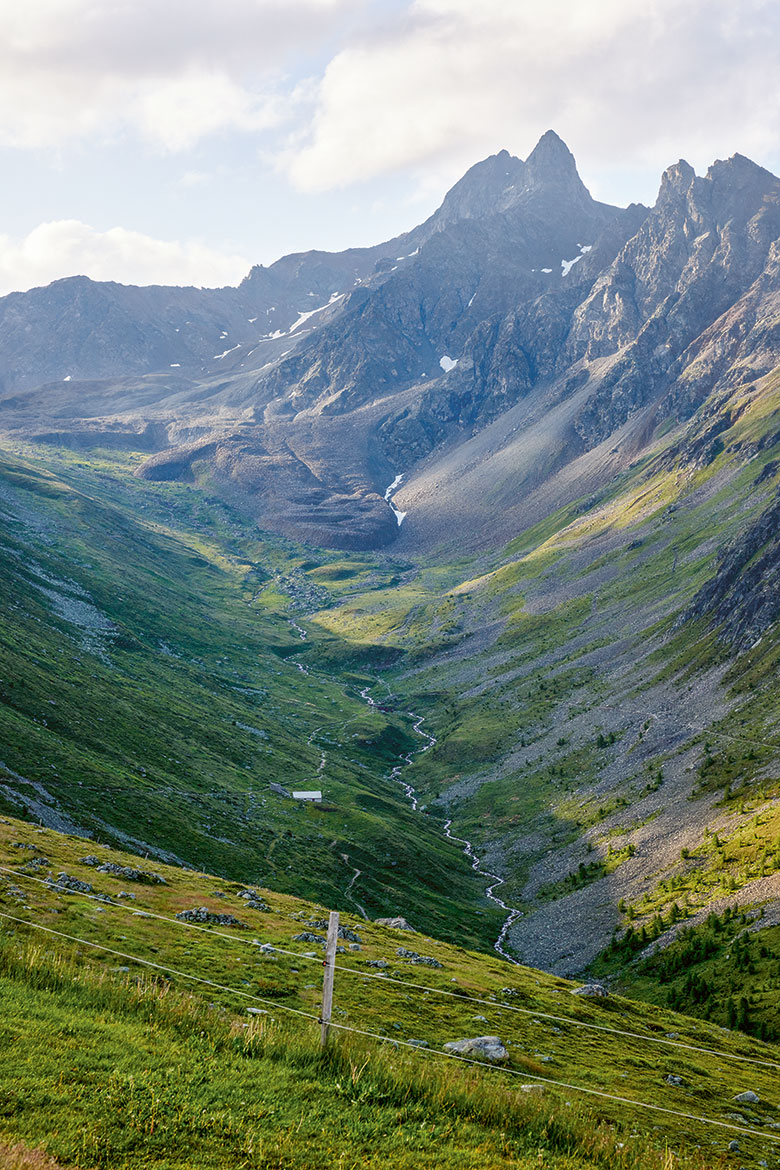
This tenacious brown mass, its surface bulging, creeps down the mountain at a rate of one metre per year.
Matthias Lichtenegger is a doctoral student who’s investigating movement within these jagged monsters. He believes that there are several thousand of them in Switzerland.
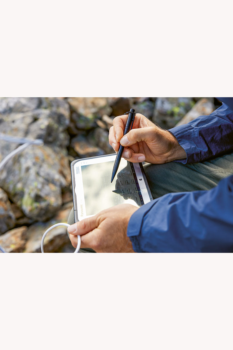
Lichtenegger transfers weather data from the measuring station to his tablet on the spot.
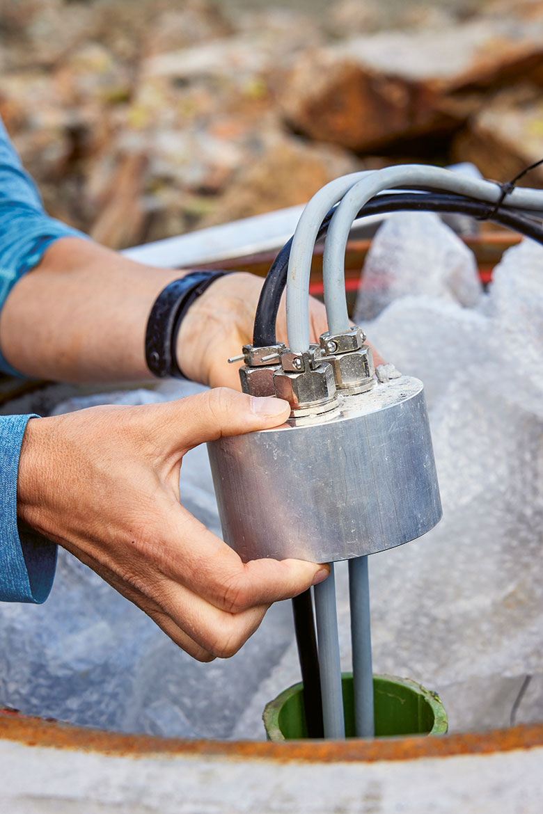
The new PERMOS borehole is well camouflaged under its cover. For roughly a year now, it’s been delivering even more precise measurements of the temperatures in the frozen subsurface.
Jeannette Nötzli has been observing the state of the permafrost in the Swiss Alps for decades now. “The changes that we measure there are the result of the long-term developments at the surface. They are a signal from the climate”.
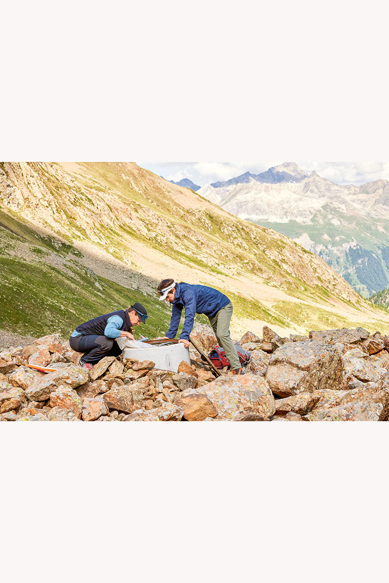
Nötzli and Lichtenegger are now trying to lift one of the borehole covers from a hole drilled back in August 2024. They try several times, but in vain. So they look for suitable tools in their bags, which prompts Nötzli to suggest an innovative idea beyond her specific area of expertise: “These rucksacks should be transparent!”. Everyone laughs. In the end, they manage to move the heavy iron disc with a simple trick: by simply throwing stones at it. There are plenty of them here for the purpose – and they succeed in loosening the jammed cover.
There is a thin green tube inside the concrete casing; inside it are three cables with temperature sensors that run deep down into the rock glacier. They get their electricity supply from a small solar panel. “The sensors near the surface register every cloud that passes by. The further down they go, the lesser the fluctuations in temperature”, says Nötzli.
Climate signals, 20 metres below
Day and night can still be detected in the metre nearest the surface, but at a depth of around ten metres, the sensors detect only the changes that occur between winter and summer. “The time delay down there is already half a year. We are currently seeing the temperature caused by last winter”. At a depth of 20 metres and more, everything is delayed by years. “A single hot summer is barely registered down there”, says Nötzli, “but ten hot summers make an impact”.
Finally, at the depth of so-called zero amplitude, you cannot read any more annual fluctuations at all. “The changes that we measure there are the result of the long-term developments at the surface. They are a signal from the climate”.
In the new PERMOS borehole that was drilled at the same time as those made for the current research project, the team is taking multiple measurements at the most important depths – just in case cables or sensors should break or malfunction. That can be caused by avalanches, storms or shifts in the scree. They have also installed both analogue and digital temperature chains. “This enables us to compare the long-term efficiency of the sensors”, says Nötzli.
“It’s like a research project within the monitoring project”, adds Lichtenegger. The entire system, set up in 2024, represents a synergy between the monitoring network, which has been running for decades, and their current research project, which has been running for four years. “It’s a nice example of how things work together”, says Nötzli. “The Swiss permafrost research community is small, but the PERMOS monitoring network brings us all together”.
Lichtenegger wants to find out just what causes the movement in a rock glacier: “Of course it’s cool that we already have so much data from this location, and that we can now take additional measurements”. He is also analysing the pore water pressure, for example. “It’s not the same everywhere”, he says. “At the top, the material is quite coarse, but further down there’s gravel and fine sediment”.
He also has a camera and instruments for meteorological data ready on site to help with his measurements. He uses them to document the air temperature and the intensity of solar radiation. They’ve also installed further new equipment to measure the electrical resistance between two boreholes and the deformations that exist inside the rock glacier.
Few exceptions to online transfer
Now Lichtenegger and Nötzli swing the borehole cover back over its concrete socket and close it up. Lichtenegger climbs up the ridge to the weather station so he can transfer their data to his tablet. Almost all their information is sent online these days, but there are still a few exceptions.
Unfortunately, the transmission gets stuck this time, and, since the weather conditions are getting increasingly uncertain, we have to head back to the mountain station of the funicular. And as the brown-grey ridge of rocky debris disappears behind us, our conversation slowly also drifts back to everyday life in the valley.